|
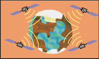 |
Problem:
It is your anniversary, and you are meeting your spouse at a local Atlanta restaurant. Your spouse calls you to tell you the name of the restaurant, but the cell phone cuts out before you can receive the information. Return calls go to the voice-mail. Luckily, you notice that your phone received the pseudo-ranges, calculated from 4 GPS signals, of your spouse's location, via the cellular company's protocol. Based on the pseudo-ranges, you attempt to determine your spouse's location, and get yourself out of trouble.
|
|
|
Technical Data:
The received pseudo-ranges of your spouse's location are tabularized below. The pseudo-range values are relative to the first satellite position.
| 0.000000000 s |
-0.001587009 s |
-0.001373255 s |
-0.001092284 s |
In the calculations, the values for these constants are used:
Radius of Earth = 6380.0 km
Altitude of GPS satellite = 20,200.0 km
Speed of light = 299,860.0 km
The equation used to calculate the location is:
(xi - ux)2+(yi - uy)2+(zi - uz)2 = (PRi - c τ)2 where i = satellite number
|
|
|
Technique:
- Convert latitude and longitudes of each GPS satellite from spherical coordinates to Cartesian coordinates
- Enter the Cartesian coordinate values into the coordinate equation above
- Solve the equations to determine the Cartesian coordinates for the true location
- Convert the resulting Cartesian coordinates back into spherical coordinates
- Determine appropriate solution from results (look for one with valid radius)
- Enter the latitude and longitude coordinates into Google Maps
- Determine the restaurant from the map
Following the above technique, MATLAB 7 R14 was used to calculate the Cartersian coordinates of the latitudes and longitudes of the GPS satellites.
| |
| 43.2345 |
35.5221 |
29.0510 |
40.7777 |
| -62.3256 |
-85.2234 |
-90.9760 |
-95.0234 |
| 8.9940e6 |
1.8007e6 |
-0.3958e6 |
-1.7624e6 |
| -1.7150e7 |
-2.1550e7 |
-2.3233e7 |
-2.0050e7 |
| 1.8207e7 |
1.5455e7 |
1.2907e7 |
1.7360e7 |
These values were put into the equation form, and using Maple 9.02, the equations were solved.
| |
| 0.1271710729 |
-991640.1367 |
9954469.328 |
-6689184.662 |
| -0.6896623642e-1 |
519396.8847 |
-5278149.767 |
3546822.260 |
The resultant Cartesian coordinates were converted back into spherical coordinates with MATLAB.
| |
| -33.7694 |
95.6889 |
1.2034e7 |
| 33.7727 |
-84.3799 |
6.3803e6 |
The difference in the radius of the first solution states that the cellular handset is 6.5641e6 meters above the surface of the Earth. The difference in the radius of the second solution is 328.0661 meters. Although the radius for the second solution may not be exact, it is far more realistic than the first solution. The final value has the latitude and longitude coordinates: (33.7727, -84.3799).
|
|
 |
Results:
The technique above gives the coordinates: (33.7727, -84.3799). Google Maps puts (33.7727, -84.3799) at the corner of Myrtle St. and Ponce de Leon Ave.
When driving to this location, you discover one of the most fabulous restaurants in the entire South. It is the one and only Mary Mac's Tea Room.
Directions:
Mary Mac's Tea Room
224 Ponce de Leon Ave.
Atlanta, GA 30308
|
|
|
|
And in case you forgot our previous wonderful report.... sarsat.html |
|
