
 Orbital Mechanics
The satellite constellation proposed for Martian Global Positioning System consists of a total of 15 satellites spread across 5 planes with 3 satellites in each plane. The satellites are in a circular orbit with an elevation angle of 90 degrees. This elevation angle was chosen so as to provide reliable coverage over the entire Martian surface, including the poles. The satellites complete 1.3 revolutions each Martian Day. The orbital radius was chosen so as to provide maximum coverage with minimum number of satellites.
AGI's Satellite Tool Kit was used to simulate and test constellation patterns for coverage and DOP. The constellation with the least number of satellites and optimal DOP was chosen. Polar coverage is ensured with high reliability. Since this system requires a line-of-sight link with a minimum of 4 satellites at all times, the minimum number of satellites could not be reduced any further. The availability of satellites varies with time and location, but a minimum of 4 satellites will be visible at all times. The constellation can be seen in the following video.
The video shows Mars with 15 satellites revolving around it. The white region on top of the Martian surface is the Martian North pole. The yellow lines depicts RF link between the satellites and the Ground MPS receiver. The yellow lines converge at the ground receiver. All the satellite planes intersect at the poles as shown in the picture. The satellites are spaced at equal distances between each other in each plane.
Complete Orbital Specifications
Plane Number |
Satellite Number |
Semi-Major Axis (km) |
Indlination (deg) |
Right Ascension (RAAN) (deg) |
True Anomaly (deg) |
1 |
1 |
16859.2 km |
90 |
0 |
0 |
2 |
16859.2 km |
90 |
0 |
120 |
|
3 |
16859.2 km |
90 |
0 |
240 |
|
2 |
1 |
16859.2 km |
90 |
72 |
24 |
2 |
16859.2 km |
90 |
72 |
144 |
|
3 |
16859.2 km |
90 |
72 |
264 |
|
3 |
1 |
16859.2 km |
90 |
144 |
48 |
2 |
16859.2 km |
90 |
144 |
168 |
|
3 |
16859.2 km |
90 |
144 |
288 |
|
4 |
1 |
16859.2 km |
90 |
216 |
72 |
2 |
16859.2 km |
90 |
216 |
192 |
|
3 |
16859.2 km |
90 |
216 |
312 |
|
5 |
1 |
16859.2 km |
90 |
288 |
96 |
2 |
16859.2 km |
90 |
288 |
216 |
|
3 |
16859.2 km |
90 |
288 |
336 |

The 2D view shows the ground trace of the satellite orbits. The yellow line represents RF links from the MPS receiver to the MPS satellites. In this picture the receiver is located at the Martian equator. The following plots show the number of satellites overhead at any time of the day for different site latitudes.
Coverage at Equator
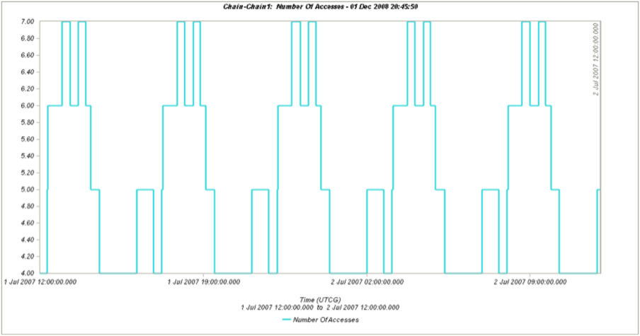
Coverage at 30º N

Coverage at 45º N

Coverage at 60ºN
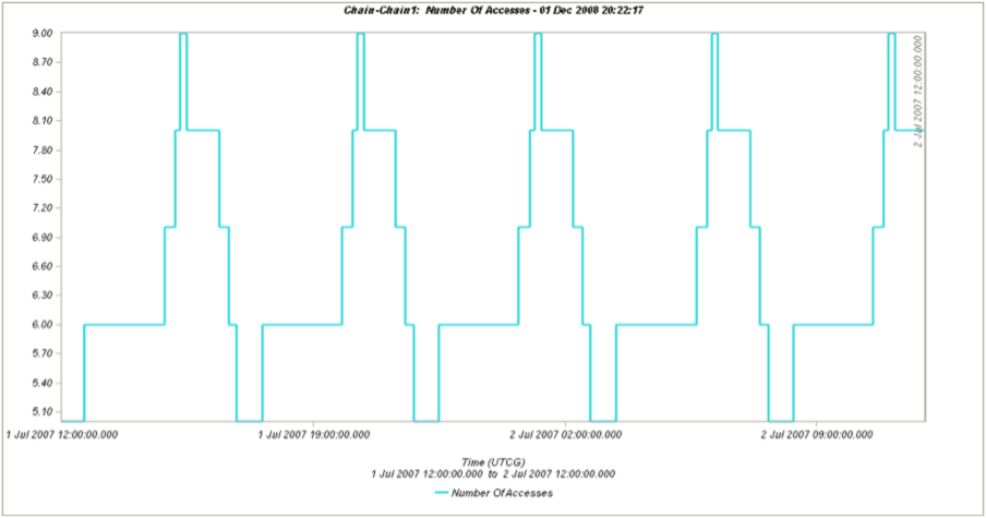
Coverage at the North Pole
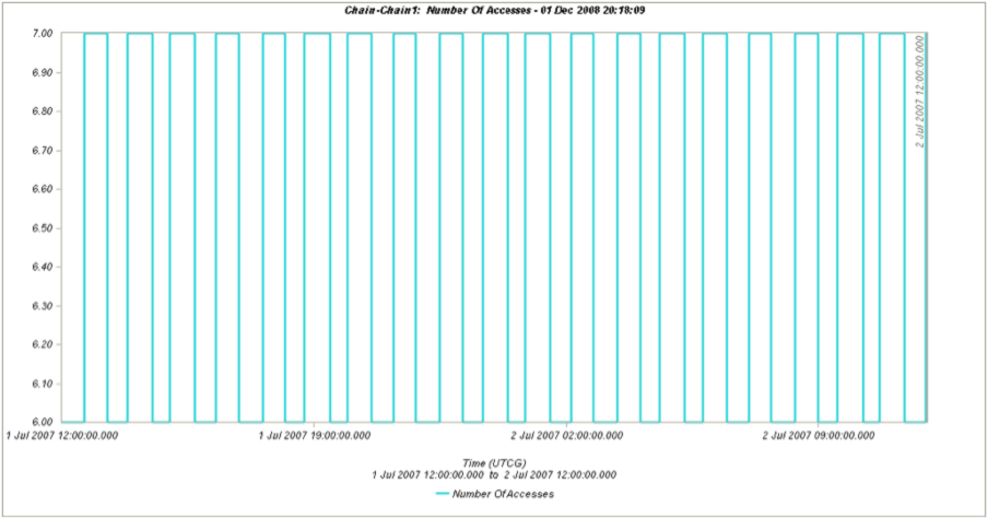
From the coverage plots it can be seen that the basic requirement of 4 satellite availability is met 100% of the time and also at times more than 4 satellites are visible.
Redundancy
It is possible that one of the satellites in the system might stop working before the system is due to be replaced. Under such circumstances it is ideal to have redundant satellites in orbit that can replace the satellite that is not working. For added systen reliability, one redundant satellite is placed in every orbital plane. This results in a total of 5 redundant satellites. The additional satellites can be activated via the Earth-Mars relay upon notification of a failure. If two satellites fail in one plane, then an additional launch is required to replace it. Loss of more than one satellites per plane will not render the system inoperable however. The system can still provide position information, but the 5 meter accuracy specification will no longer be met everywhere on Mars. The added cost of the redundant satellite is much lower than the cost of a single additional launch to replace a failed satellite.