Rferences
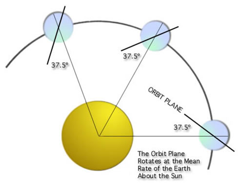
Figure O1. Sun-synchronous orbit showing constant orientation with respect to Sun (from www.spaceyuga.com)
Various orbit configurations were considered in determining the mission architecture. The primary orbits considered were a geostationary orbit (GEO), middle Earth orbit (MEO), or a highly elliptical low Earth orbit termed a Borealis orbit. Each different orbit has both upsides and downsides that were evaluated for usefulness for this mission. A satellite in GEO would be stationed directly over the ground station, allowing for constant coverage with no need for transfers (or handoffs) between satellites. However, due to the high altitude of this orbit, it would be extremely expensive to launch the desired mass. The MEO orbit considered was a circular orbit at an altitude of approximately 10,000 km. The Borealis orbit was a highly elliptical orbit with perigee at an altitude of about 630 km and a perigee altitude of about 7,600 km, inclined at 116.6 degrees such that the orbit is sun-synchronous. A sun-synchronous orbit is an orbit that passes over a given point on Earth at the same mean solar time. This is achieved by choosing the altitude and inclination of the orbit such that the oblateness of the Earth causes a desired precession of the orbit. While this type of orbit is often chosen for its surface illumination characteristics (desirable for surveillance satellites, for instance), it was chosen for this mission for the fact that the orbit remains at the same angle with respect to the Sun at all times. This is illustrated in Figure O1.
One of the highly desireable properties of the Borealis orbit is that it provides good coverage of the Northern hemisphere due to the high ellipticity and inclination of the orbit. By placing five satellites each in two Borealis orbits, one with a longitude of the ascending node (LAN) at 0 degrees and the other at 180 degrees, a constant coverage of the Northern hemisphere can be provided.
Due to the high cost of inserting large masses into GEO or MEO, the Borealis orbit was chosen. However, this presented some challenges. As one of the ground stations is two degrees below the equator (in the Southern hemisphere), the Borealis orbits do not provide continous coverage of all ground stations. Thus, it was necessary to remove two satellites (one from each of the two Borealis orbits) and place four total satellites in an inclined medium Earth orbit (MEO). It was judged that the additional cost of twelve total satellites (as opposed to the eight necessary for a GEO orbit configuration), would still be justified by the high costs of a GEO orbit insertion. This is true partially because of the declining cost of each additional satellite constructed due to a standard applied learning curve.
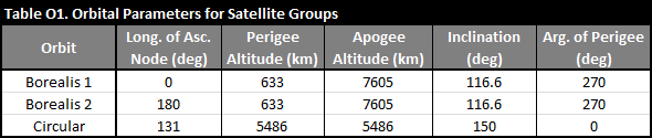
The orbital parameters for each of the satellite groups is shown in the table below.
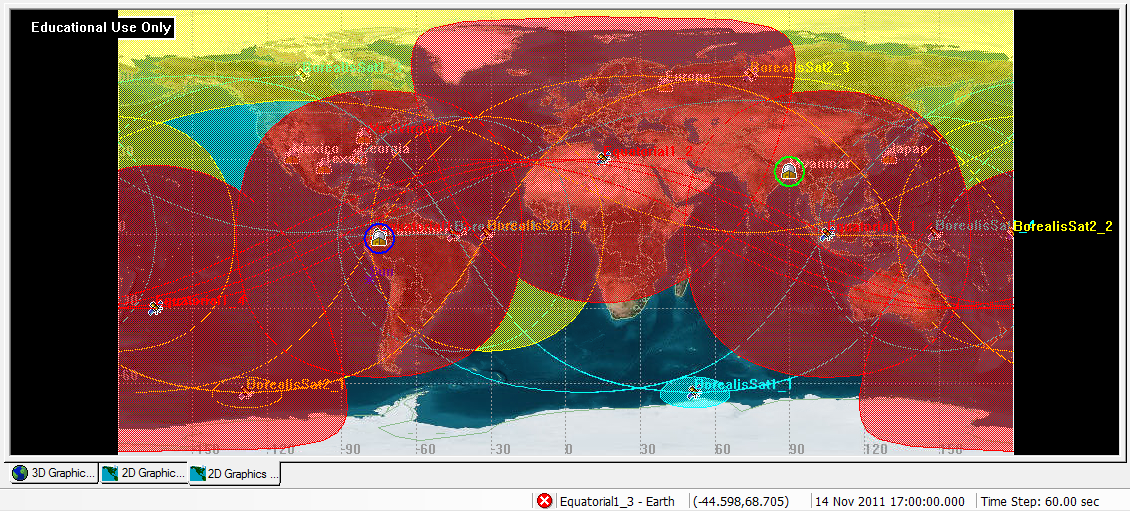
The coverage of each ground station by the twelve satellites was found using Satellite Tool Kit (STK). In order to determine coverage, each satellite was given a transmitter dish capable of angling itself up to 22.5 degrees off center/nadir. This provided the ground coverage that can be seen in the images below (for all satellites and one satellite respectively). This first image, with showing coverage for all satellites, uses different colors for different orbits (blue for Borealis 1, yellow for Borealis 2, and red for the circular orbit).
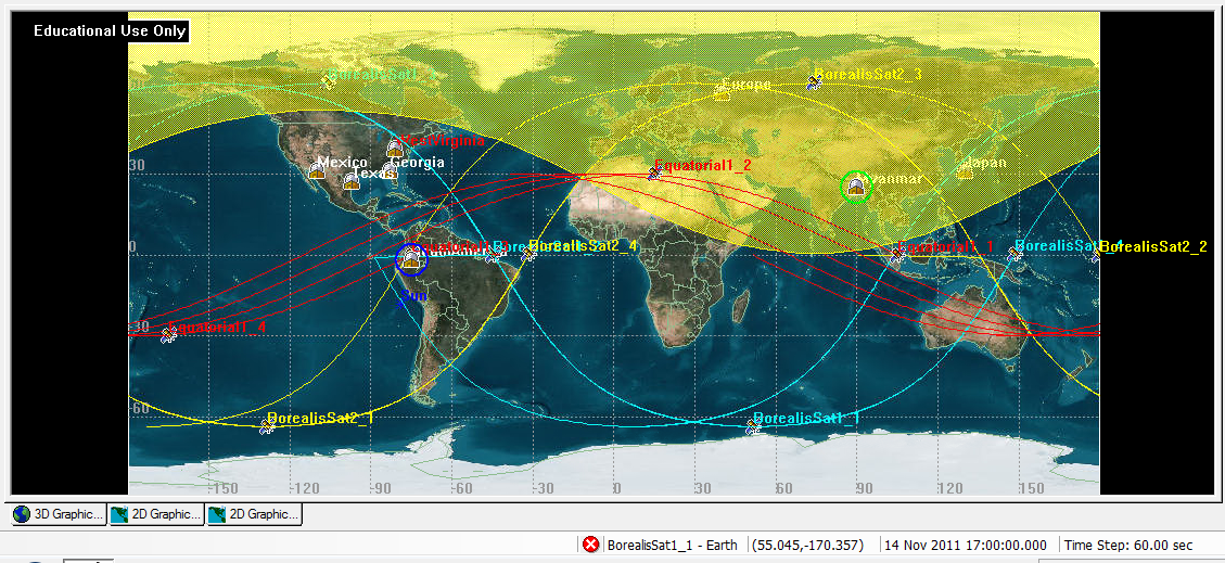
This second image shows the coverage for just one satellite in a Borealis orbit, along with the ground tracks for the rest of the satellites.
The coverage analysis for two ground stations (sites at South America and Myanmar) is shown below, illustrating that these satellites provide continuous coverage.
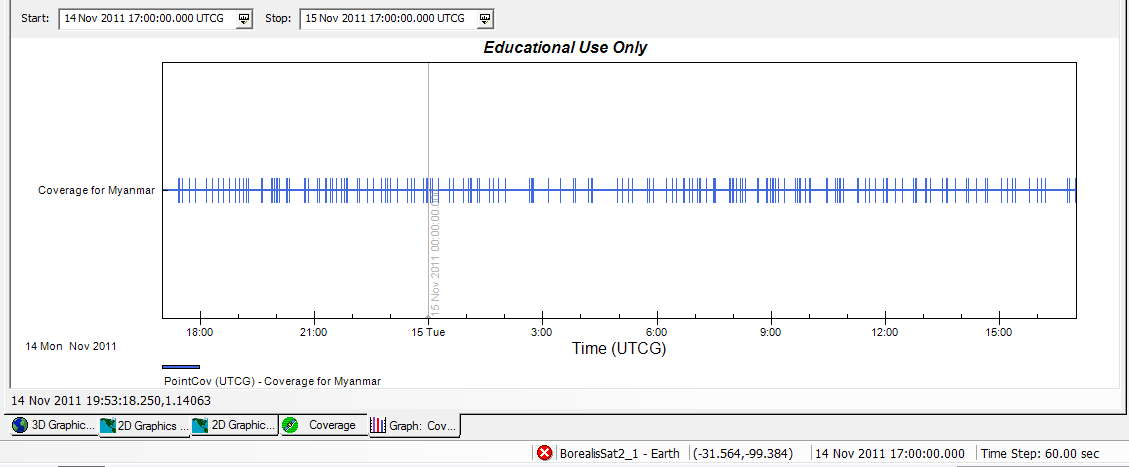
Figure O4. Myanmar coverage analysis
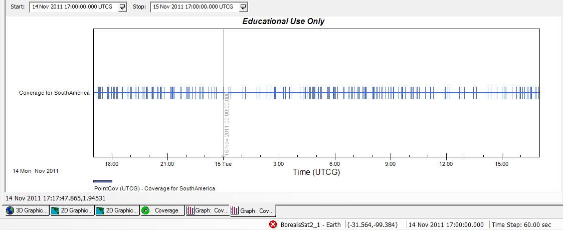
Figure O5. South America coverage analysis